Secrets of the Maya: Deciphering Tikal

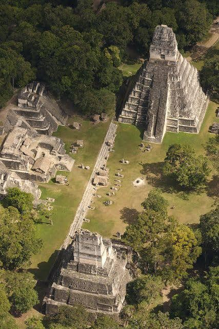
Tikal is a complex of Mayan ruins deep in the rainforests of northern Guatemala. Historians believe that the more than 3,000 structures on the site are the remains of a Mayan city called Yax Mutal, which was the capital of one of the most powerful kingdoms of the ancient empire. Some of the buildings at Tikal date to the fourth century B.C.
Tikal, or Yax Mutal, was an important city in the empire of the Maya from 200 to 900 A.D.
The Mayan ruins have been part of a national park in Guatemala since the 1960s, and in 1979 they were named a UNESCO World Heritage site. Tourism has been credited with providing the funds to restore and maintain the Tikal, and a museum has been open there since 1964.

Tikal History
Historians believe that people lived at Tikal as far back as 1000 B.C. Archeologists have found evidence of agricultural activity at the site dating to that time, as well as remnants of ceramics dating to 700 B.C.
By 300 B.C., major construction of the city of Yax Mutal had already been completed, including several large Mayan pyramid-style temples.
Starting in the first century A.D., the city began to flourish culturally and politically, overtaking the city of El Mirador to the north in terms of power and influence within the Mayan empire, which stretched as far north as the Yucatan Peninsula in Mexico.
Archeologists have discovered evidence of burials of notable Mayan leaders dating to this time at Tikal.

Yax Mutal
Hieroglyphic records found at the site suggest it was seen as the seat of power for the Mayan ruler, Yax Ehb Xook, who ruled much of the surrounding lowland region at the time. The city thus took the name Yax Mutal in his honor.
By the early third century A.D., the leader Chak Tok Ich’aak ruled Yax Mutal; he is believed to have ordered construction of the palace that eventually formed the foundation of the city’s Central Acropolis, the remains of which are still standing today.
The next 300 or so years marked a period of near-constant warfare for the city and its occupants.
By the start of the fifth century A.D., the city’s rulers commissioned construction of an elaborate system of fortifications, including ditches and earthworks, along the northern periphery of the city, which joined with natural swampland defenses to the south, east and west to effectively form a protective wall around the city.
The fortifications protected the city center as well as its agricultural areas—in all, a total of more than 40 square miles.
Subsequent rulers continued to expand the city well into the eighth century A.D. and, at its peak, Yax Mutal is believed to have had a population as high as 90,000 people.
Collapse of Mayan Empire
By 900 A.D., the city, like much of the Mayan empire, was in sharp decline. Decades of constant warfare started to take their toll. In addition, at around this time, historians believe the region fell victim to a series of droughts and outbreaks of epidemic diseases.
This period is known as the collapse of Classic Maya.
Specifically, for the area around Tikal, historians believe overpopulation and the resulting deforestation led to crop failure, and people chose to abandon the city rather than starve.
Soon, the city was largely vacant, its large palaces occupied by migrant farmers.
Interestingly, the area around Tikal had a sparse population long before the arrival of the Spanish colonialists in the 1500s. In fact, the new arrivals to the region were reportedly unaware of site or its past significance.
It wasn’t until the mid-19th century that European explorers “discovered” Tikal and began writing about its treasures.
Tikal Ruins
Researchers from the University of Pennsylvania, with the support of Guatemalan government, have been credited with restoring many of the remaining structures at Tikal in the 1950s and 1960s.
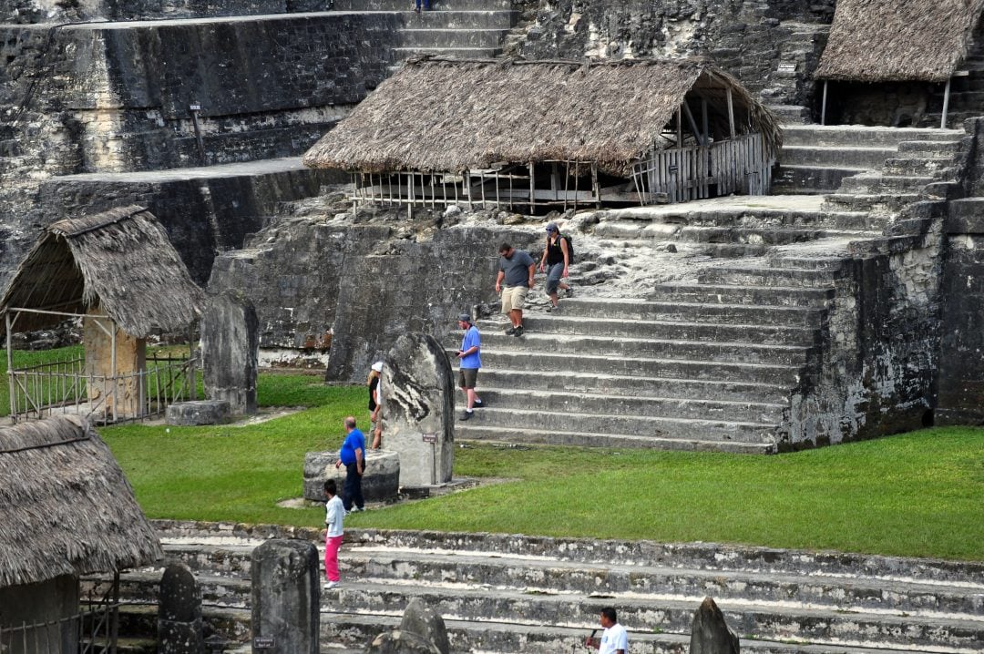
Most of the cities buildings were made of durable limestone, and thus many have endured.
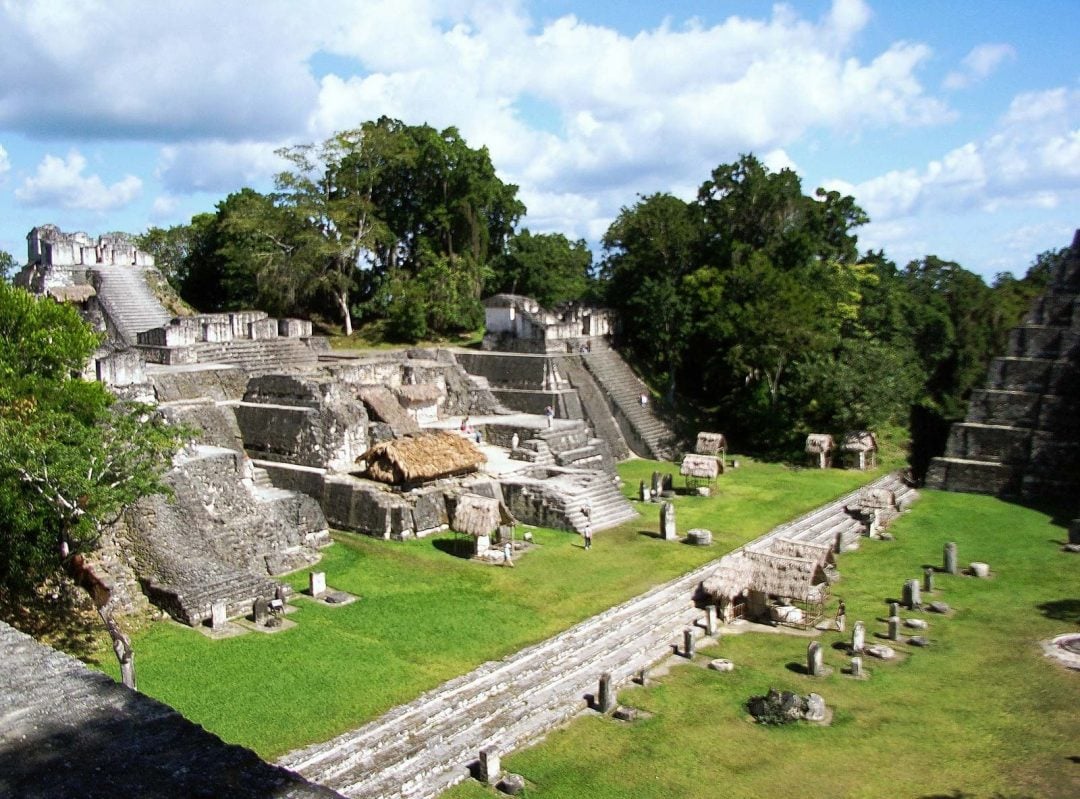
Notable structures that are still in evidence include:
- The Great Plaza, or main square of the city
- The Central Acropolis, which is believed to have served as the main palace for the city’s rulers
- The North Acropolis
- The Mundo Perdido, or “lost world” temple, a large Mayan pyramid
- The Temple of Ah Cacao or Temple of the Great Jaguar, a Mayan pyramid that served as a burial site and stretches more than 150 feet high
- Temple I, an image of which adorns the 50 centavo note in modern Guatemalan currency
In addition, there remains evidence of the city’s system of sacbeobs, or paved causeways, as well as an intricate series of canals designed to capture rainwater and feed the city’s reservoirs. There are also the remains of several ballcourts used for playing the so-called Mesoamerican ballgame.
Tikal National Park
Archeologists are still working at Tikal and hope to map and excavate the areas that are believed to have served as the residences for the majority of the population. From the mid-1950s through the early 1970s, excavation and restoration work was overseen under the auspices of the University of Pennsylvania’s Tikal Park project.
Researchers working for the Tikal Project identified the remains of more than 200 structures at Tikal.
In 1979, the work of the Tikal Project was taken over by the Guatemalan government, which oversees the site today.
However, tourism is the primary function of Tikal National Park today, and has been for more than 50 years.
In the 1950s, researchers at work restoring the site built an airstrip to service archeologists and historians, as well as tourists visiting the site. Today, though, Tikal National Park is connected to the rest of Guatemala via a network of highways.
In 1977, director George Lucas used Tikal as a location for the first-ever Star Wars film, Episode IV.
